Experience > VisitPA,Google Earth,Gigapan Collaboration
VisitPA, Google Earth, Gigapan Collaboration
VisitPA website: http://www.visitpa.com/google-earth Microsite: http://pacivilwartrails.com
Pennsylvania Tourism collaborated with Google Earth and Carnegie Mellon University to develop a new way to interact with Pennsylvania. The first application was with the Civil War Trails. Information about the Civil War Trails appeared on the main PA Tourism website (VisitPA), a microsite, Google Earth, and Gigapan. PA provided information to appear on Google Earth that visitors could move through. The information contained things such as battlefields, historic places, historic towns, etc. In addition, there were Gigapan photos that could appear on Google Earth and on the Gigapan website that provided highly detailed photos related to the Civil War sites. The purpose was to provide a more interactive way for users to learn about the Civil War in Pennsylvania.
I interacted with the customer to understand the purpose of the website and needs of the users. From this information and further research about the different audience members, I developed a sitemap that gives an outline of the VisitPA website and microsite; content outline that provides details about the outline of the VisitPA website and microsite; wireframes that displays what information should appear on a page and the ways in which the information can be interacted with on the VisitPA website, microsite, and Google Earth; and wireframe notes that provide details about the elements on the wireframes.
Below are snapshots for the work I performed with links to download more information.
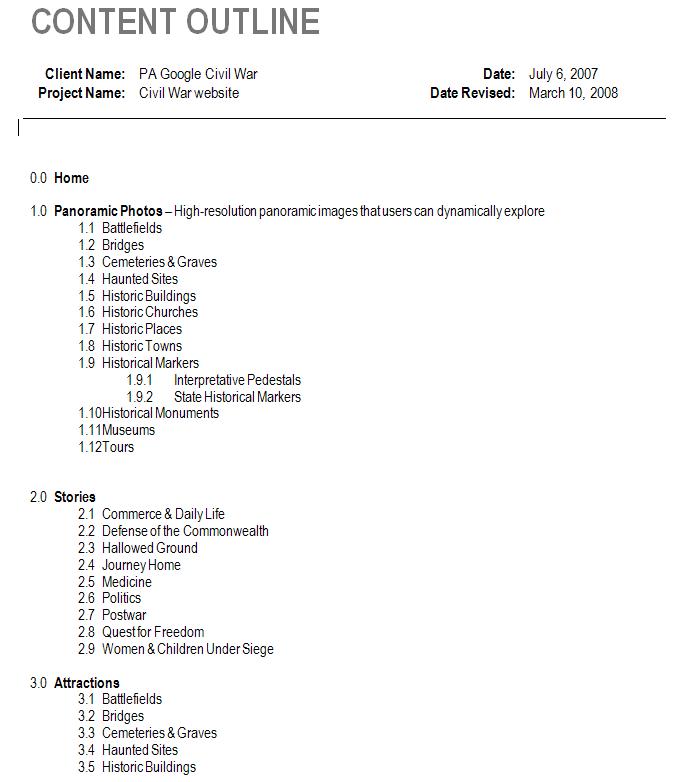
CONTENT OUTLINE Download Content Outline
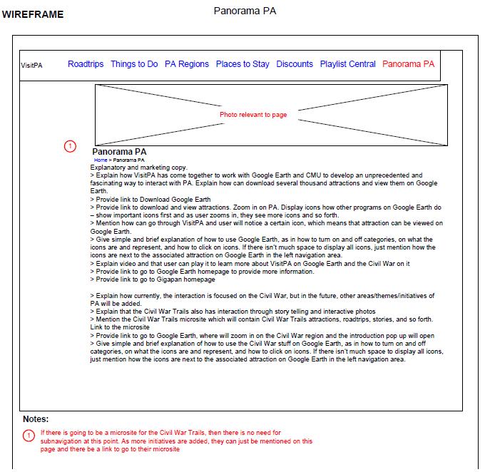
Microsite Wireframe Snapshot Download Microsite Wireframes
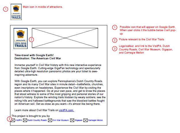
Google Earth Bubble Wireframe Snapshot Download GE Bubble Wireframes